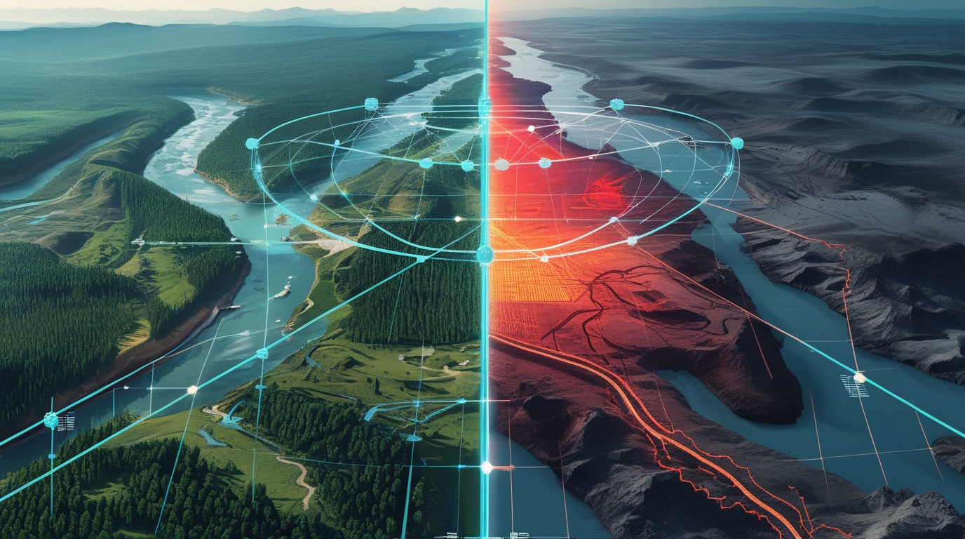
Satellite-Based Before vs After Change Detection using Geospatial ML



Overview
GeoShift is an MVP system that detects and visualizes landscape changes using multi-temporal satellite imagery. By comparing “Before vs After” scenes, the system automatically highlights areas that have undergone transformations such as:
✔ Deforestation ✔ New constructions & roads ✔ Water body shrinkage ✔ Urban expansion ✔ Agricultural land-use shift
The project demonstrates remote sensing + machine learning + temporal analysis, making it suitable for environmental monitoring & geospatial AI portfolios.
Streamlit App Demo
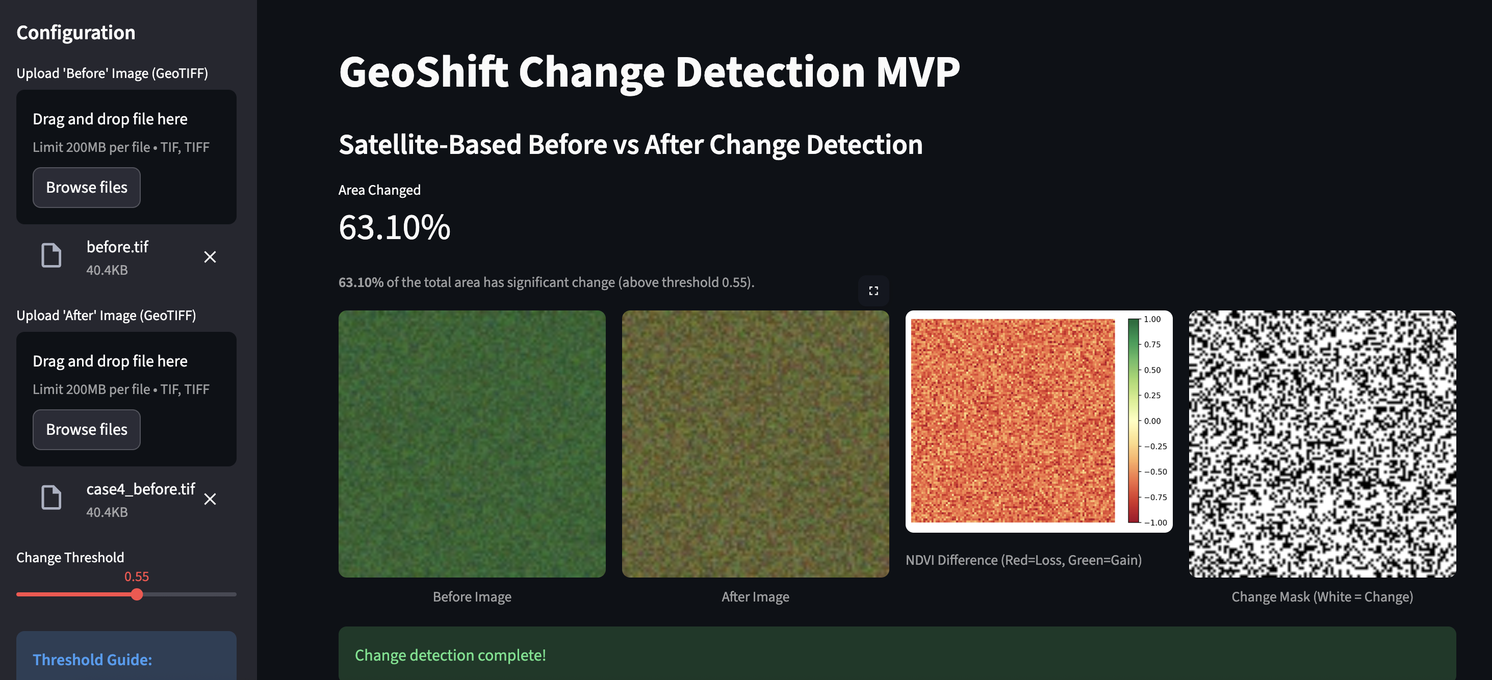
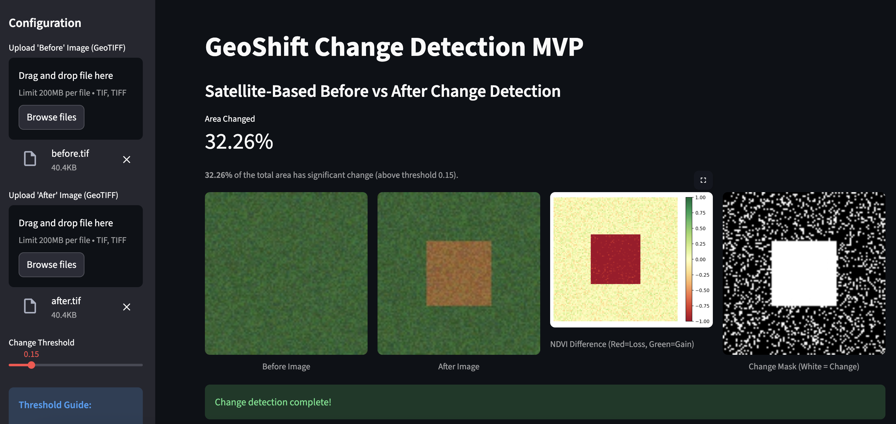
Below is the visual interface of the GeoShift app detecting landscape changes using uploaded satellite images:
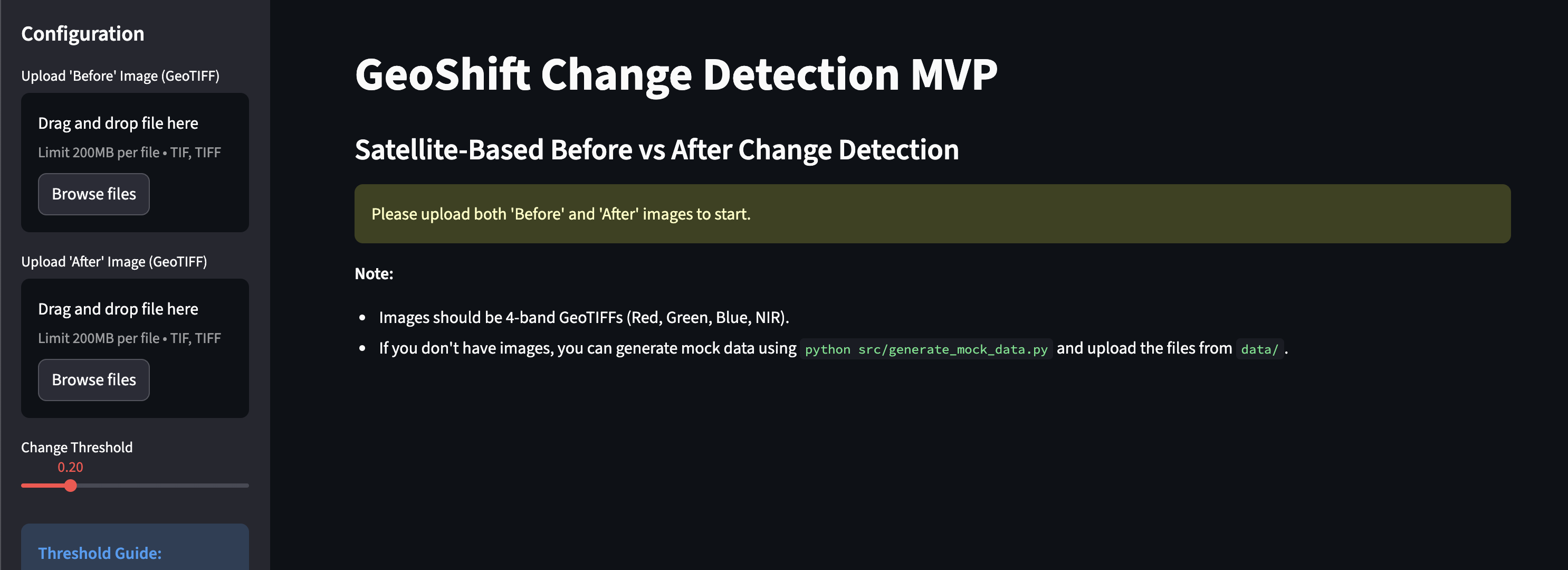
Home Screen — Upload Before/After imagery
Key Features
| Module | Capability |
|---|---|
| Data Acquisition | Upload "Before" and "After" GeoTIFF images |
| Pre-processing | Basic raster alignment (reprojection) |
| Change Detection Engine | Spectral Change Detection (NDVI Differencing) |
| Visualization Layer | Difference Heatmaps + Change Masks + Side-by-Side Comparison |
| Output Metrics | % Area Changed, GeoTIFF Mask Export |
 YouTube Series: Building GeoShift
This repository is accompanied by a YouTube Shorts series titled “Building GeoShift: Geospatial ML Project.”
The objective of the series is to document and explain the complete journey of the GeoShift project in a simple and practical way — covering:
- What GeoShift is and the problem it solves
- Why automated land-change detection is important
- How satellite imagery and machine learning are used
- Technical decisions behind the MVP
- Real-world use cases and future possibilities
The series is designed to break down complex geospatial and AI concepts into short, easy-to-understand 30-second episodes.
Playlist
Channel
📅 New episodes are uploaded every Monday.
Follow along to see how GeoShift evolves from idea to implementation!
Spectral Change Detection (MVP baseline)
- Compute NDVI/NDWI/NBR for both timestamps
- Generate difference raster:
delta = im_after - im_before - Threshold differences to create change mask
- Overlay mask on original scene for visualization
Tech Stack
| Category | Tools |
|---|---|
| Language | Python |
| Geospatial Processing | Rasterio, NumPy |
| ML / CV | OpenCV, Matplotlib |
| Data Source | User Upload / Synthetic Mock Data |
| Visualization | Streamlit |
| Deployment | Local Streamlit Server |
Project Structure
GeoShift-Change-Detection/
│── data/               # input imagery + output masks
│── src/
│   ├── preprocessor.py       # image alignment + band extraction
│   ├── differencer.py        # NDVI change computation
│   ├── generate_mock_data.py # synthetic data generator
│   ├── debug_ndvi.py         # debug script for NDVI values
│   ├── test_differencer.py   # unit tests for differencer
│── results/            # heatmaps, overlays, reports
│── app.py              # Streamlit frontend
│── requirements.txt    # dependencies
│── README.md
How to Run
# 1. Clone the repository
git clone https://github.com/SukritiC/GeoShift-Change-Detection.git
cd GeoShift-Change-Detection

# 2. Install dependencies
pip install -r requirements.txt

# 3. Generate mock data (Optional, for testing)
python src/generate_mock_data.py

# 4. Run the application
streamlit run app.py
License
This documentation and conceptual content are distributed under the Apache License. See the LICENSE file for more information.